







Oil based solar plate monoprint
27 x 35” 2017
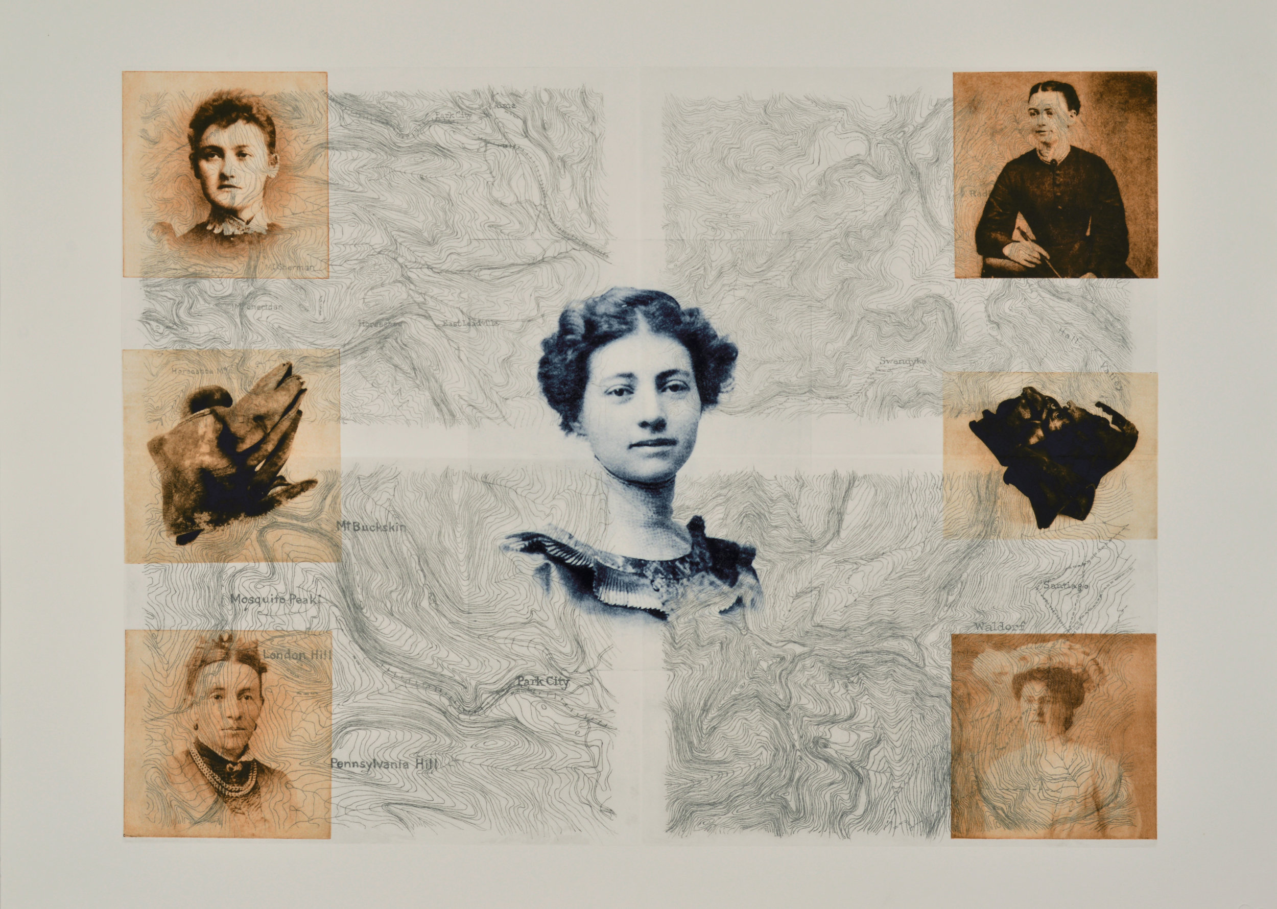
Layered images of sourced historic photographs, photographs of artifacts, and hand drawn topographies
This work presents images of five of the fifteen women I researched for the project, with Eula Smith (about whom I learned the most) as central. All lived and/or worked for part of their lives in Park County, Colorado, and their images are layered over topographical landscapes of nearby areas with historic mining sites I visited. These topographies were sourced from the earliest hand drawn surveys in the USGS collections. They were then redrawn as overlays to include specific locations of artifacts that indicate the presence of women. The text "she was here" can be seen on close inspection, referencing the location of the artifacts and where I stood in their presence. Here the women are embedded back into the landscapes their lives had impacted. (Top left: Rosanna Peart; top right: Lillian Hall; center: Eula Smith; lower left: Cornelia Burns; lower right: Ada Richards)

Oil based solar plate monoprint
26 x 32” 2017
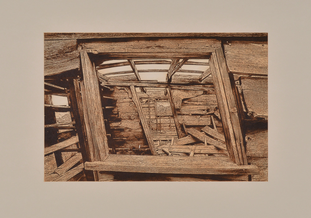
Altered image of a photograph taken of the barely standing eating house structure at the Geneva City mining site
This structure is slowly succumbing to gravity with the degree of lean increasing with each visit. It’s an eating house at the site of Geneva City and many of the storage shelves for food stuffs remain. Geneva City was a mining establishment along Geneva Creek, bordering Clear Creek and Park counties. The image has been altered a bit from its original photograph to more closely resemble the aesthetic of the printed image in the late 19th century, as it might appear in a newspaper or leaflet. There are several still barely standing structures in this area, including individual miner’s cabins and a stable, all of which were built by hand.

Oil based solar plate monoprint
19 x 23” 2017
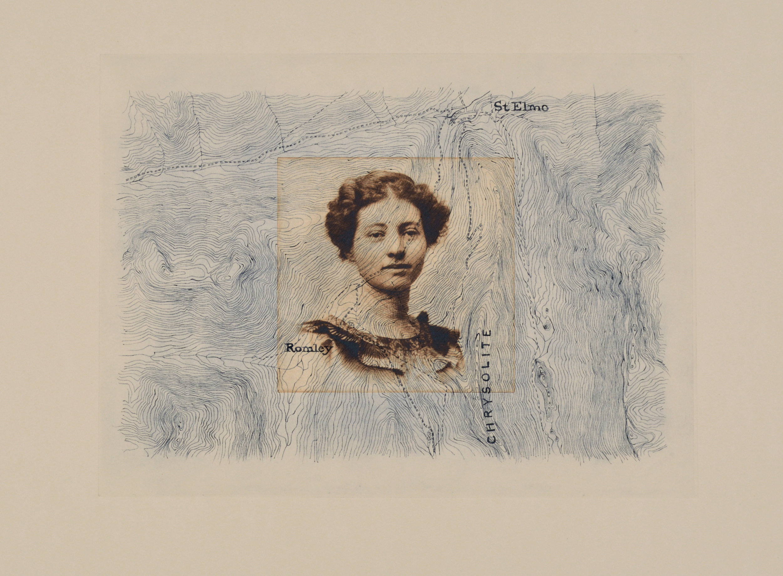
Layered image of historic photograph and hand drawn topography.
The woman whose image appears here is Elsie Henderson (1894-1971) embedded into the redrawn landscape around the Mosquito Range in Park County, a prolific area of mining activity in the late 19th century. Elsie spent her early life in a small town called Hartsel, eventually moving to Denver with her parents. She worked as a stenographer and a clerk and one might deduce from her dress and appearance that her family was privileged. This work often appears with "Eva in Hall Valley" and "Eula and Mary Murphy" as a triptych, and within each topography the location of artifacts indicating the presence of women is indicated.

Oil based solar plate monoprint
19 x 23” 2017
Layered image of historic photograph and hand drawn topography
Featured here are images of Eula Smith (1887-1973) overlayed onto the landscape around the Mary Murphy mine site (named after a nurse that cared for the mine owner) in Chaffee County. Eula was from a prominent family that hailed originally from Fairplay and started pursued her life's career as a teacher while she was still a student. She traveled around the state of Colorado, running one room schoolhouses early on, eventually settling in Greeley where she taught until she retired. Modeled by her parents, she was civically minded, supported women's organizations and was once known by her students as "six foot Smith". This work often appears with "Eva in Hall Valley" and "Elsie and the Mosquito Range" as a triptych, and within each topography the location of artifacts indicating the presence of women is indicated.

Oil based solar plate monoprint
18 x 22” 2017
Layered image of historic photograph and hand drawn topography
The woman whose image appears here embedded into the landscape around Hall Valley, a prolific area of mining activity in the late 19th century, is Eva Grant Parmalee (1853-1914). Eva lived in Park County, and her husband George Parmalee and his mother Huldah were connected to the Salt Works there. She is recorded to have been the post master at Buffalo Springs, which may account for her attire, which seems to resemble a uniform. This work often appears with "Eula and Mary Murphy" and "Elsie and the Mosquito Range" as a triptych, and within each topography the location of artifacts indicating the presence of women is indicated.

Oil based solar plate monoprint
26 x 30” 2017
Layered image with photographs of artifacts and hand drawn image referencing 1800s mining claim maps
Two images of artifacts appear here, a drill bit and a shoe sole, over a dizzying array of geometric lines. This backdrop of numerous layers of hand drawn rectangles references historic mining claim maps, which showed the location of individual mining claims. These maps would quickly build up into layered diagrams as others got news of a claim, and went to the same location to stake their own. The resulting maps not only documented the placement of claims but also were documents of human greed. This piling up of small parcels of land were an accumulation of projected hopes and dreams of striking gold. Here the identities of claim holders and their land is lost in favor of a humorous poke at greed gone wild, with the only residue being the tools and garments left behind.

Oil based solar plate monoprint
26 x 32” 2017
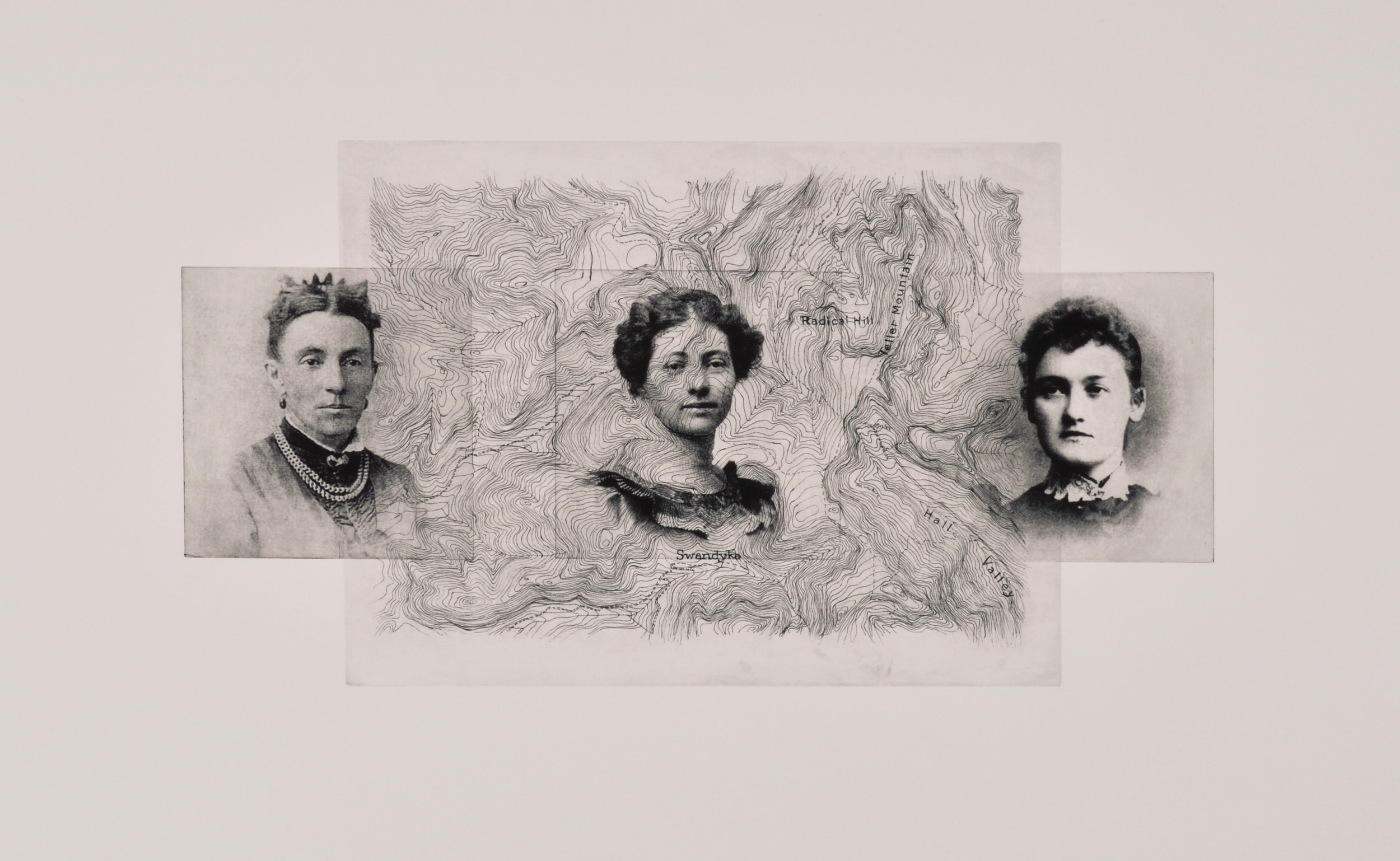
Layered image of historic photographs and hand drawn topography
The three women whose images appear here all spent time in Park County, Colorado. Cornelia Burns (left, 1836-1905) is only recognized in historic documents by her paternal attachments - as the “daughter of D.J. Monroe” and “wife of William Burns”. Not much else is known other than her being divorced with three children at age thirty five, which was unusual for the time. Eula Smith (center, 1887-1973) was the oldest daughter of the prominent Smith family that spent its early days in Fairplay and she devoted most of her life to being a teacher. Rosanna Peart (right, 1874-1901) emigrated from Ireland to the United States with her family (her father John Peart was a miner). She was only twenty six when she died unexpectedly of an embolism in 1901 shortly after her son was born. Unfortunately, he joined her a few months later.
The topography that appears is sourced from the earliest hand drawn survey from the USGS of an area that bridges Summit and Park Counties, where several early mining towns were established (many mines and structures remain today in Hall Valley). As this area was redrawn by hand for this work, embedded within are locations where artifacts were discovered that indicate women were present.

Oil based solar plate monoprint
33 x 25” 2017
Layered images of sourced historic photographs, photographs of artifacts, and hand drawn topographies
The topographies of the historic mining areas around the Mosquito Range and Revenue Mountain are present here, overlayed with an image of Lulu Cassell (1873-1930) and two images of artifacts - mother of pearl or bone buttons, and shards of delicate hand painted china. These artifacts are examples of the type of artifacts found at mining sites that evidence the presence of women (miners would not own/use fine china and their garments would have had stronger fasteners). Lulu Cassell was from a family that owned a large ranch and other land holdings and she had a reputation of being somewhat eccentric. Upon her passing, there were several mentions in the two Denver newspapers about estates sale of her property, and she is buried in a family plot, although there is no marker with her name. Within each topography the location of artifacts indicating the presence of women is indicated.

Oil based solar plate monoprint
24 x 29” 2017
Compilation image of sourced historic photograph and photographs of artifact and notched beams
Three images appear in this monoprint, all sourced from photographs - Elsie Henderson (1894-1971) from the Park County Local History Archives, and two detail photographs. Elsie had origins in Park County, and was later employed as a stenographer and clerk in Denver. The detail photographs show a tobacco tin artifact and notched wood beams from Park County and together form an identity of sorts from this particular time and place. The color palette for this series of monoprints is decisive, referencing stained or faded historic documents with an overall sepia tone that also alludes to a time in the past.

Oil based solar plate monoprint
20 x 24” 2017
Layered image of sourced historic photographs and hand drawn topography
The Park County Local History Archives proved to be a great resource in trying to piece together the lives of some of the women who lived and worked there. Four of those women are featured here and given rightful place as anchors to their community. Many worked on ranches and homesteads with their families, others eventually left for other opportunities in career or family. Here they are visible alongside the landscape where they lived and worked, including that which also covers much of the mining activity around Park County at the end of the 19th century. Top left: Effie Craig (1865-1929, worked the Craig Ranch); top right: Lulu Burns (1869-1924, raised family with husband who was a traveling blacksmith); lower left: Anna Weber (1869-1947, family owned a Livery in Alma); lower right: Annie Bender (1844-1910, worked the Hammond/Bender ranch.

Oil based solar plate monoprint
26 x 32” 2017
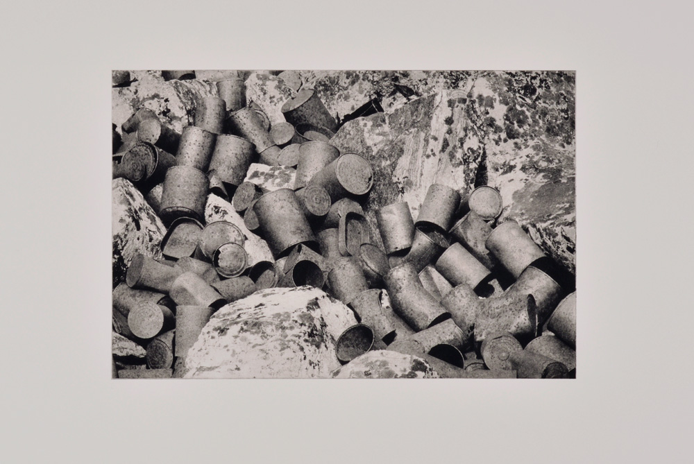
Can dumps can be compelling, as are their inherent contradictions. They indicate a heavy human presence and/or town site where people resided and the dumps offer clues as to what those humans ate and drank. However, they are also reflective of a form of disregard for the surrounding environment and wilderness. Many can dumps are nearby eating houses or other mining structures, and when the contents of the cans were emptied, people would literally toss them out the window (or down a hillside) into a pile. The photograph that was rendered as a solar plate for this image reveals the similar surfaces of the rusting cans amidst the rocks covered in lichen. Both the rust and the lichen only occur over long periods of time, and both tell different stories of that time passing - the deterioration of the human made vs. the accumulation of what occurs undisturbed in nature. This particular can dump is located at the end of Mosquito Gulch in Park County.

Oil based solar plate monoprint
26 x 32” 2017
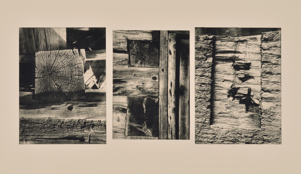
It is a marvel to witness and stand amidst large wooden structures, built by hand, that are still standing after 100-150 years. Located at high elevations and remote locations, covered by snow half the year, they are testament to human ingenuity and fortitude. It's also an opportunity to appreciate their construction and architecture, all rendered by hand with hand tools before electricity, including the details shown here. This work gets up close to reveal this residue of the hand, as well as the inherent beauty and strength of aged wood beams - an aesthetic only afforded by many decades of exposure.

Oil based solar plate monoprint
24 x 30” 2017
Hand drawing of cam, printed cross section of a beam and image of an artifact
The three companion images in this monoprint all relate to a specific site located near Mosquito Pass in Park County, the South London Mine site which is part of the larger London Mining district. The image on the left is a drawing of a detail from the interior of one of the structures, a large cam that operated the cabled tram system that lowered ore down the mountain. The architecture and hand notching systems that support these impressive cast iron mechanical objects are compelling and they are likely still in place because of their heft and structural integrity. The image on the top right is a cross section of the grain of a wood beam, similar to those used to build these structures. The image of the artifact on the lower right is a ceramic insulator, used to hold early electrical wires that were incorporated into mining operations in the late 19th century.

Oil based solar plate monoprint
12 x 16” 2017
Sourced from brush & ink drawings on acetate
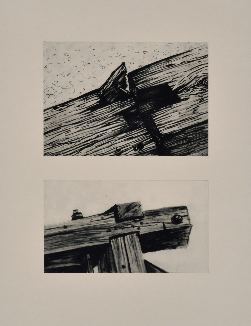
A continued fascination with hand hewn notching systems is celebrated here, in the form of two brush and ink drawings that were rendered into solar plates. Each drawing is from a different site with the image on top being a large beam from a structure at the site of Rexford that had fallen to the ground. The image on the bottom focused on the notching of the beams that still supported a large cast iron cam wheel that ran the cabled tram system at the Hilltop site between Mt. Sherman and Mt. Sheridan. The brush and ink work celebrates the wood and its grain, and reveres the integrity of these hand built structures.

Oil based solar plate monoprint
26 x 32” 2017
Layered image of ghost print of can dump with artifacts
This work presents three artifacts, laid over what’s called a “ghost print”, or a second pass of a plate that has already gone through the press (and still has some ink left to transfer to the paper). The hazy quality of the can dump seems fitting here, as well as the literal and figurative implications of these discarded objects being ghosts. The can dump itself is located at the end of Mosquito Gulch, near the supposed original town site of Mosquito, of which only traces remain. The artifacts are also from nearby sites along Mosquito Gulch. They are the remants of a shoe sole (with tiny screws intact), a drill bit tip from a hand drill, and a tin with the letters “Norvege”, the shape and lettering which may indicate herring or another canned fish from Norway.